Is there any real threat to Mada forests ??
Recently, we have been witnessing a huge campaign going viral in social media to protect Mada forests from destruction in the state of Andhrapradesh. This social media campaign gained traction when a petition was filed in the National Green Tribunal (NGT) by some environmental activists and the NGT immediately ordering for a committee to enquire into the whole issue. People on social media have been posting various photographs on how these mangrove swamps have been levelled by the government with mud near Kakinada of East Godavari district. They also started a petition in change.org and gathered the support of many people to sign the petition. This campaign also added some political colour when the opposition parties in the state started to add voice to it.
Putting facts together on threats to Mada forests
Mada forests are dense mangrove forests located on the coastal region of Andhra Pradesh. The state has total of 404 sq.km mangrove cover spread across various costal districts. We can find majority of these mangrove forests in Krishna estuary and Godavari estuary.
According to the India state of the forest report (ISFR) 2017, the state of AP registered a net increase in mangrove cover of 37 sq.km since 2015.
These mangrove forests are considered as lifeline for people living across the coastal regions as these forests protect their coastal habitations from natural disasters like cyclones and also provide livelihood for the people in those regions.
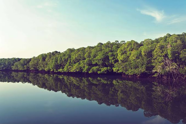
The below image shows the Reserve Forest in the Godavari estuary
The present demand for protection of Mangrove forests surfaced after the state government of AP is allegedly felling the mangroves near Kakinada bay region to construct houses for the poor. Many un-authenticated images are being circulated in social media showing large clearance of trees and successively filling the area with mud. The IT cells of different parties used these images for their own advantage.
The below is the NGT's interim order on petition against mangrove destruction.
Prior to the petition in the NGT, some fishermen living in the region had approached Honourable Hight court of AP to stay the construction activity citing the lockdown regulations imposed from March 22,2020. Accordingly,the High court stayed the construction activity and asked the state government to reply to the petition.
The present construction activity which was objected is located behind Kakinada seaport.
The circled part in red represents the region where the housing project was initiated by the government and it is present outside the Coringa reserve forest region.
Let us see whether actually any construction activity is carried out in this region.
Below are the images from Sentinel-2 satellite of European space agency showing the change in land use over three months.
This image is taken from the month of February 2020.
This image is taken from the month of April 2020.
This image is taken from the month of May 2020.
From the above images we can see that levelling of green cover has indeed happened over months and majority of the work was carried out in the month of March 2020.
Now,coming to the allegations,we have to check whether the cleared green cover is a mangrove swamp or not.
To get more clarity on it, I have referred to the Mangrove atlas of Andhrapradesh prepared by MS Swaminathan research centre.
Here is the land use change in the godavari estuary over the years.
Landuse map in 1986 shows some degraded mangroves in the region. See the circled region.
Landuse map in 1998 shows resurgence of some dense mangrove cover in the circled region. There was some growth in the mangroves in the region from 1986 to 1998.
Landuse map of 2002 shows that the mangroves from the circled region disappeared and was converted in to agriculture land. This disappearance of mangroves in the region may be attributed to commissioning of Kakinada deep water seaport in the year 1997 or it can also be attributed to growth of aquaculture in the region.
Going by the landuse map provided in the Mangrove atlas, the region where the construction activity was initiated has no mangrove presence from 2002. So, with the official data in hand,we can say that there is no destruction of any dense mangroves in the region and it is located away from Mada forests.
Some of the environmental activists are concerned that this construction activitiy may pose indirect threat to Mada forests in the future. There is no clear evidence to it as already a larger construction activity took place in the region in year 1997 with the commissioning of Kakinda port adjacent to the present contested land. Government sources say that this land lie unused from many years and the land belongs to the port.
Finally ,from the above facts we can say that there is no imminent threat to the Mada forests due to the housing project initiated by the AP government,but it may pose some danger to the people who are going to live in that housing layout as it is more proximate to the coast and they are going to be more vulnerable to cyclones in the region.


Comments